EGLIN AIR FORCE BASE, Fla. — The waterways surrounding Eglin Air Force Base and its range area are now restricted, with access limited to authorized personnel and visitors with approved passes, according to Eglin officials.

Niceville.com Community Partner
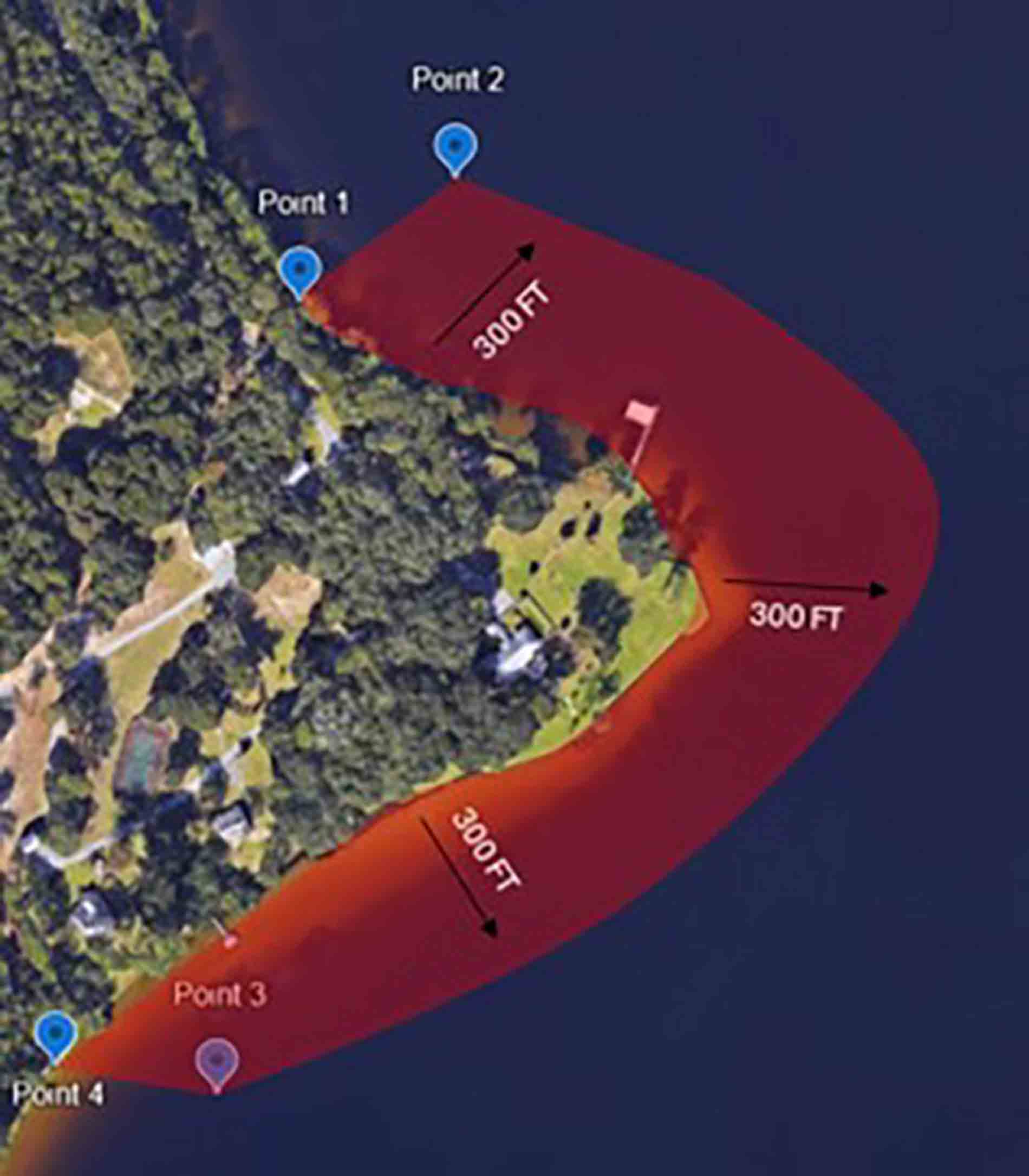
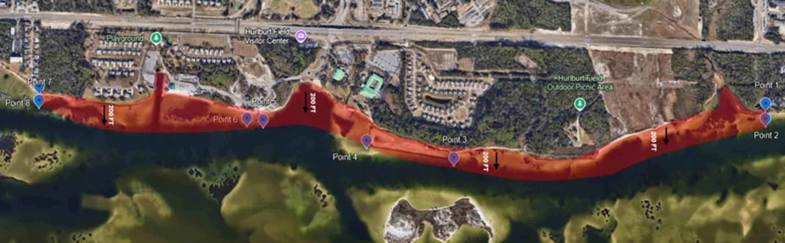
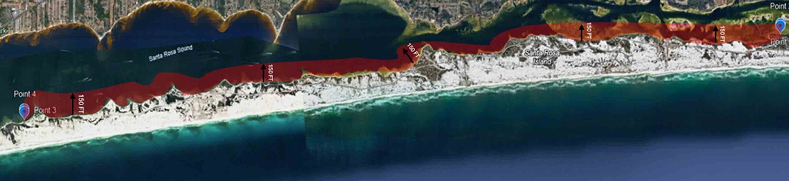
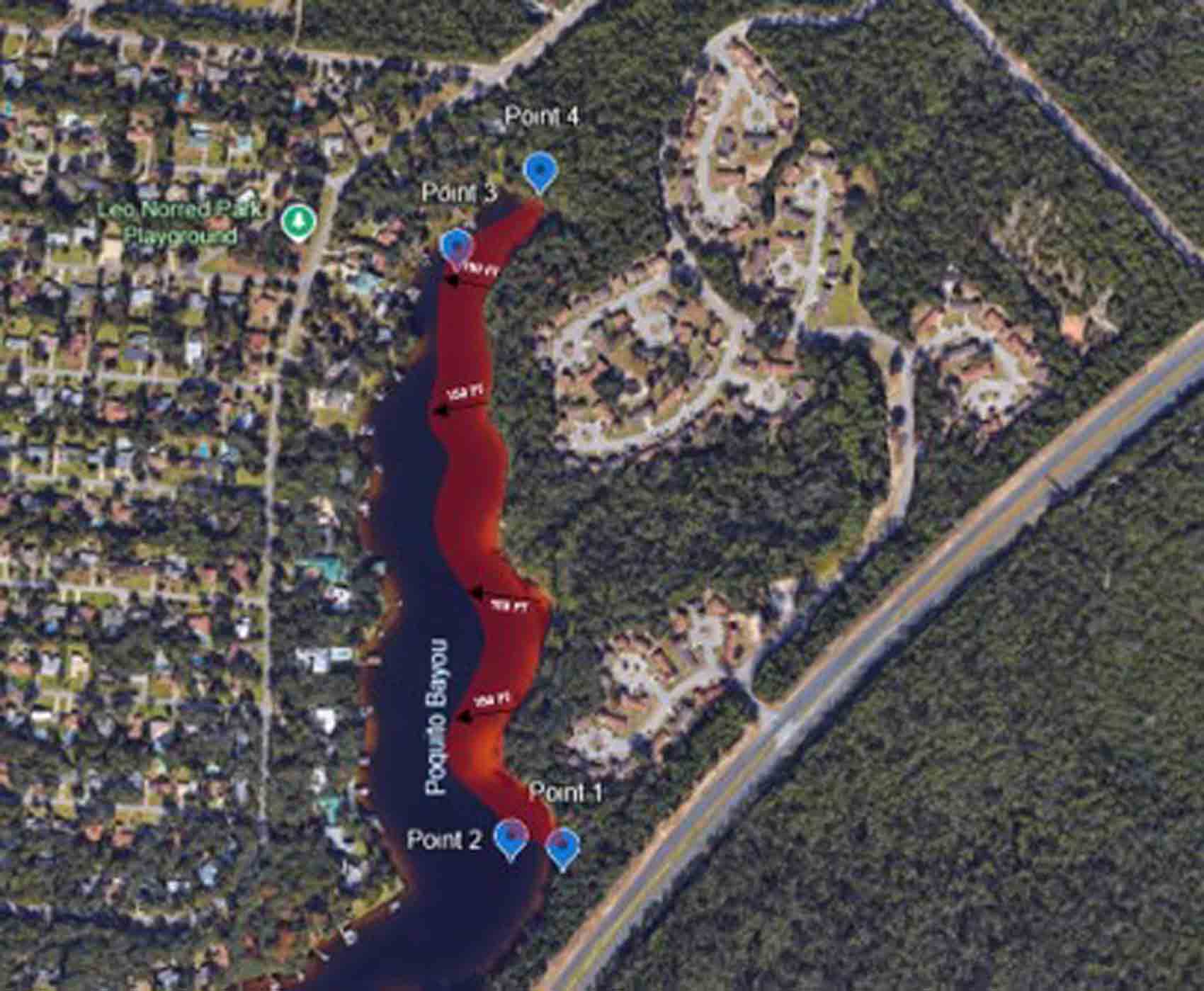
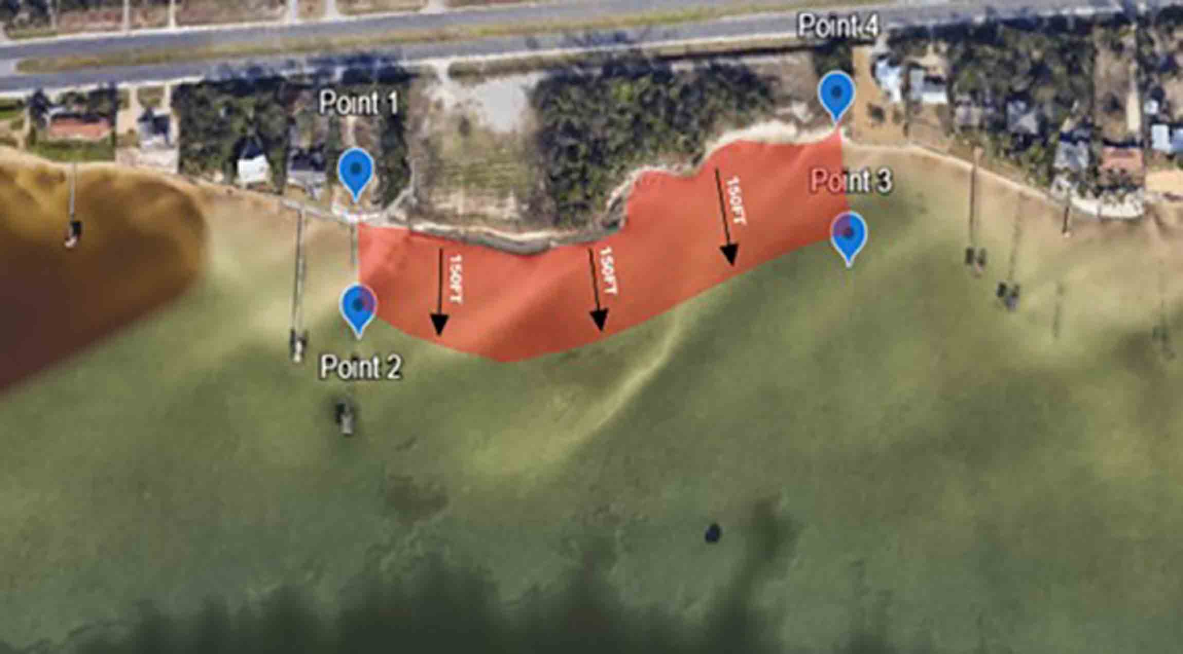
The restriction applies to six waterways, including Eglin’s main shoreline, Santa Rosa Sound (North and South sides), Camp Pinchot shoreline, Poquito Bayou housing area shoreline, and Wynnhaven Beach.
The change follows identified air and waterborne security threats to defense installations, prompting the 96th Test Wing commander to align the waterways with Eglin’s existing land security measures.
Visitor passes for authorized guests can be obtained at the Visitor Control Center at the Air Force Armament Museum. The center operates daily from 6 a.m. to 10 p.m., while sponsors can obtain base passes from Airmen at the gate between 10 p.m. and 6 a.m.
For more information, visitors are encouraged to contact Eglin Air Force Base security officials.
Satellite Image Maps of Eglin’s Restricted Waterways